SOS alerts will soon show you the path of hurricanes in Google Maps

What you need to know
- SOS alerts are being updated to show visualizations in Google Maps.
- The new visualizations will be available for hurricanes, earthquakes, and flooding.
- Flood maps will only be available in India where 20 percent of flood-related deaths occur.
Google launched SOS alerts in 2017 to provide valuable information during natural disasters or times of crisis. SOS alerts show up in Google Search and Maps to provide you with quick access to a general summary, news stories, emergency numbers, Twitter updates from local authorities, and more.
On June 6, Google announced that it's improving SOS alerts by adding detailed visualizations for hurricanes, earthquakes, and floods to Google Maps. Now, you'll not only be able to read information but also view the affected areas on Google Maps.
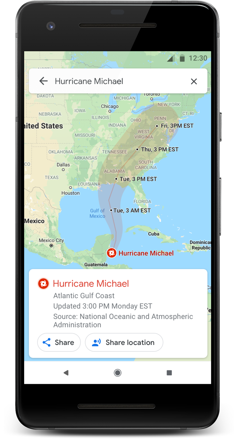
For example, if you live in the path of a hurricane, a notification card will appear in Google Maps days prior with the projected path and what time it will arrive.
This essential information could be lifesaving for those who live in the affected areas. With hurricane season upon us, it has never been more important to know the path of these storms so you can plan for evacuation or prepare to ride it out.


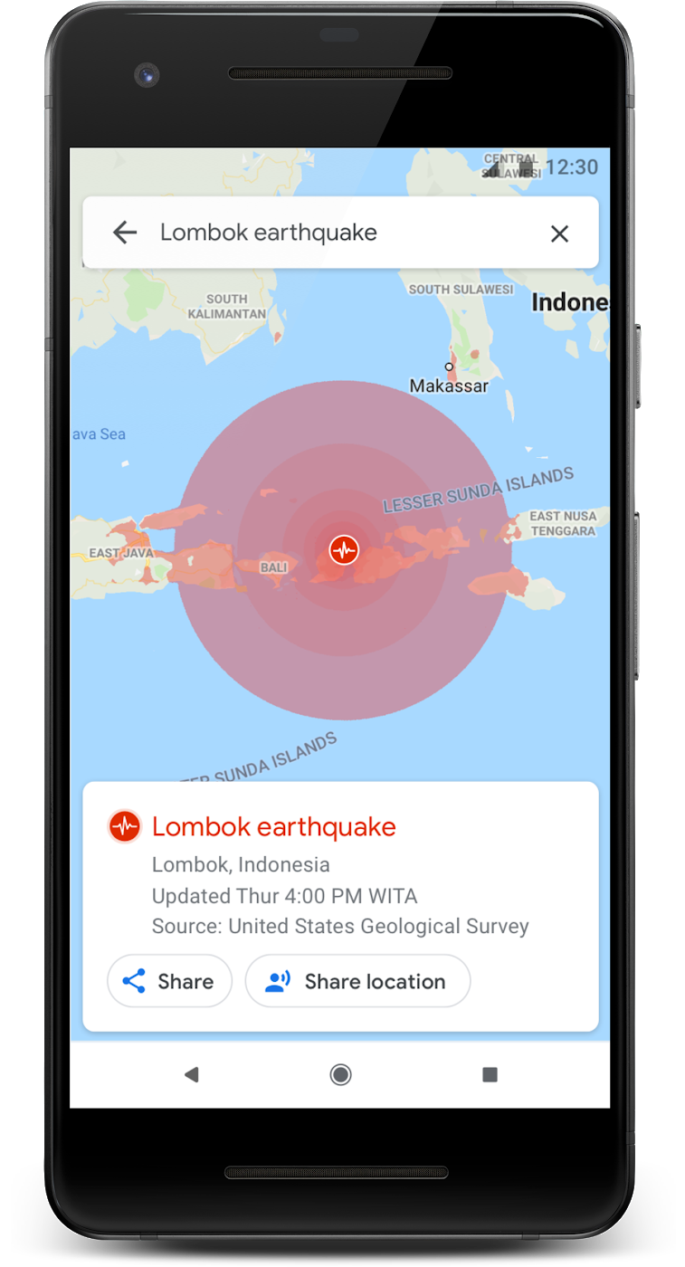
In the case of earthquakes, tapping on the card after one has occurred will reveal a shakemap showing the epicenter, the magnitude, and how large of an area was affected.
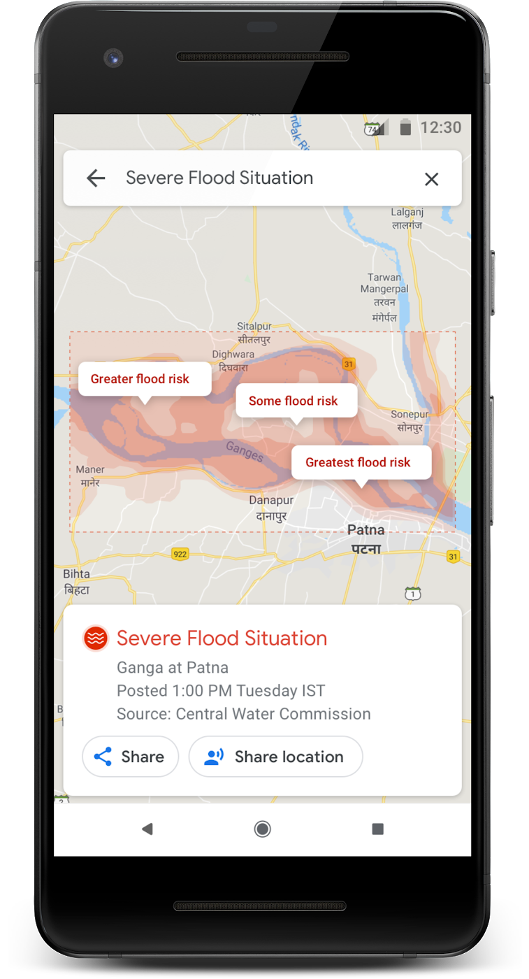
Flood maps will only be available in India where 20 percent of flood fatalities occur worldwide. With flood maps, you'll be able to see areas where flooding is happening as well as the severity.
Another update coming to Google Maps later this summer is crisis navigations warnings. Once live, this new feature will change your route to help you avoid driving through areas which are experiencing a natural disaster or crisis.
Be an expert in 5 minutes
Get the latest news from Android Central, your trusted companion in the world of Android
The new hurricane and earthquake visualizations will begin rolling out for Android, iOS, desktop, and mobile web in the coming weeks. While flood maps will be available soon on Android, desktop, and mobile web for Patna, India with Ganges and Brahmaputra are being added at a later date.
How your phone can help before and during a hurricane

