Google Maps now tells you how long a future trip will take

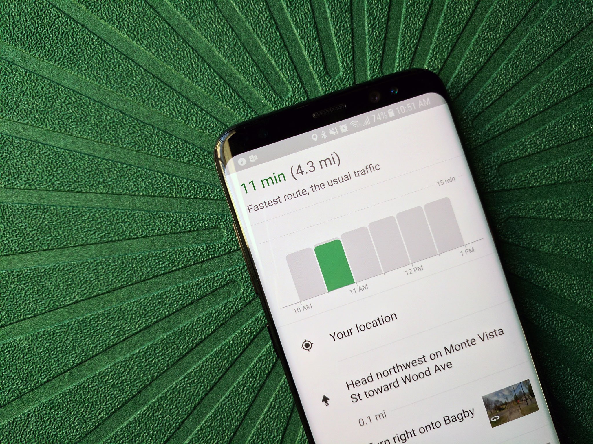
It's hard to know the perfect time to go somewhere, because there's no one outside mailmen and UPS drivers that really know when traffic is best in your city... except for Google Maps. With millions of users and millions more Waze users helping them graph traffic in real-time, day after day, Google Maps really can tell when the best time is to go run down to that trendy bistro downtown with a handy new chart.
The graph tells you how long your trip would take if you leave right now, the green bar, against the grey average times across the last half hour and next two hours. This can help you gauge whether traffic is better than average right now, or if you should consider going later when travel times are lower (like say after rush hour).
This could be a great help when planning errands or lunch dates, but given the relatively small window, it'd be nice to see this chart expand so we could see if it's better to go in the morning or afternoon, but it's still early days. It's currently available in the U.S. and UK, but hopefully, more markets will see it soon. This chart also appears to be a server-side push, as there was no app update before it appeared.
Be an expert in 5 minutes
Get the latest news from Android Central, your trusted companion in the world of Android
Ara Wagoner was a staff writer at Android Central. She themes phones and pokes YouTube Music with a stick. When she's not writing about cases, Chromebooks, or customization, she's wandering around Walt Disney World. If you see her without headphones, RUN. You can follow her on Twitter at @arawagco.

