Google expands its AI-powered flood tracking service to 60 more countries
Flood Hub uses AI to provide forecasts up to seven days in advance of a flood.

What you need to know
- Google is expanding its flood detection system known as Flood Hub to 80 countries.
- Flood Hub uses artificial intelligence to predict floods up to seven days in advance.
- The tracking service is now available in countries across Africa, Asia-Pacific, Europe, and South and Central America.
Google has announced a huge expansion of its flood forecasting service, known as Flood Hub, which is now available in 80 countries and covers 460 million people worldwide.
The expansion includes countries in Africa, Asia-Pacific, Europe, and South and Central America, with 60 more countries added to the list. Google piloted the service in the Patna region of India back in 2018, predicting floods using AI. It was expanded to Bangladesh in 2020 before being rolled out to 18 more countries last year.
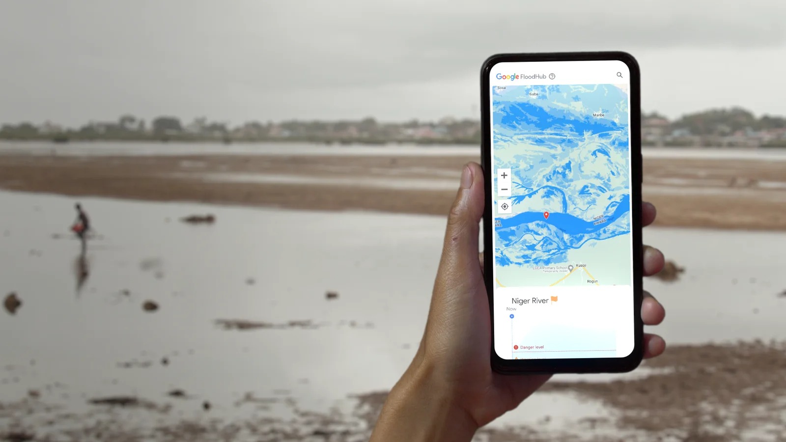
Flood Hub uses AI to forecast water levels in flood-prone areas for the next seven days, giving people enough time to get to safety. The notifications are sent to Android phones that have the Google app installed. It is also accessible to businesses and organizations involved in flood response.
However, Flood Hub is currently capable of monitoring only riverine floods, excluding flash floods or any other similar phenomena. It does this by combining two models: a hydrological model that predicts the amount of water flowing in a river and a flood model that predicts which areas will be affected and the depth of the water.
Flood warnings can be sent only if a smartphone is connected to the internet and the Google location service is turned on. Given that many areas in those regions have poor internet access, Google has partnered with the Federation of Red Cross and Red Crescent Societies, the Indian Red Cross Society, and the Yale University Inclusion Economics team to train volunteers as part of offline alerting networks.
Flood Hub works by first predicting where flooding is likely to occur before alerts are sent out. Google's researchers use data from different drainage basins to train a flood forecasting model.
The result is an interactive map that displays flood forecasts for users or first responders. Flood levels are represented by colored pins, with red indicating severe flooding.
Be an expert in 5 minutes
Get the latest news from Android Central, your trusted companion in the world of Android
Google vows to bring flood forecasting alerts to Search and Maps in the future. The expansion of Flood Hub is a significant step forward in helping communities prepare for and respond to flooding, which Google says "affects more than 250 million people globally each year and causes around $10 billion in economic damages."

Jay Bonggolto always keeps a nose for news. He has been writing about consumer tech and apps for as long as he can remember, and he has used a variety of Android phones since falling in love with Jelly Bean. Send him a direct message via Twitter or LinkedIn.
